


FAQ
- Bolivia climbing questions
-
Mallorca island and rockclimbing
- What are main specifics of rockclimbing trip to Mallorca
- Mallorca island impressions
- Rockclimbing safety Spain
- Mallorca climbing accommodation
- What season is possible for rockclimbing in Mallorca
- Transport accessibility of climbing sectors in Mallorca
- Active vacation in Mallorca
- Saint Anthony night in Mallorca
- Peru climbing questions
- Gear reviews
-
Safety in the mountains
- How NOT to climb the summit?
- Mountain navigation
- At the limit of possibilities
- Mountain thunderstorm
- Russian formalities
- Solo ascents and mountain trips alone
- Mutual responsibility in mountaineering
- Safety illusions in the mountains - a rope
- Independent team of two
- Mountain troubles
- Psychological problems in the mountains
- Health in the mountains
-
Elbrus questions
- Elbrus climbing gear
- Climbing Elbrus with children?
- Mount Elbrus location?
- Elbrus logistics
- How to get to Mount Elbrus?
- Elbrus German airfield?
- Elbrus difficulty grade
- 5 points beginner must know about Elbrus
- How to prepare for Elbrus?
- Are there avalanches on Mount Elbrus?
- Climbing Elbrus solo?
- Seasonality of climbing Mount Elbrus
- How much time climbing Elbrus takes?
- Clothes for Mount Elbrus?
- Pressure at the top of Elbrus?
- Elbrus air temperature
- Elbrus sightseeing
- How much to climb Elbrus
- Gear questions
- Mountaineering questions
- Mountain climbing training
-
Rockclimbing questions
- Rockclimbing gear
- How to choose your first rockclimbing shoes
- The hand power in roclcimbing
- What is Rockclimbing tours
- Non olymnic rockclimbing
- What is rockclimbing?
- Where do you climb?
- Where and when we organize our rockclimbing programs?
- What is rockclimbing?
- Rockcliming program class?
- Climbing motivation
- Horse riding tours
- Iceclimbing questions
-
Questions on the alpine programs
- What to climb in Morocco?
- Weekend summit climb
- Georgia 2023
- Pico Aneto - what is that mountain?
- Mountain programs format
- Mountain climbing food ration
- Queries on the alpine program climbing Mount Bazarduzu
- Top 10 Questions About Climbing Kamchatka Volcanoes
- What is combined program?
- What is sightseeing program?
- What is pilot program?
- What programs you have of the medium complexity level?
- Basic expedition rations
- Prices for the mountain climbing programs
- Queries on the Mountain Course in Adyl Su valley
- Program complexity?
- Questions about MCS AlexClimb
- Questions related to trekking programs
Mountain navigation
Outdoor offline navigation
Read in Telegram in English
Leer en Telegram en Español
Outdoor field navigation course program
What do you need to make your trips in the mountains (or just in the wild) as safe as possible?
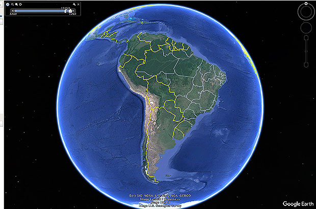
Using Google Earth to work with navigation tasks
The main rule is that one cannot single out any aspects from the concept of general security, or divide them into more or less important ones. In any critical situation, any weakness in your preparation can cause fatal consequences. Even the most primitive activities - a trip for mushrooms, or barbecue - can be a risk zone for those who underestimate the danger factors of certain types of relief.
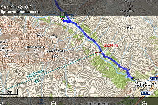
An example screen of the Locus.map software with a recorded track of climbing Elbrus
Equally important issues of general security include such areas of training as: physical and tactical training, practical experience of campaigns, high-quality equipment, communications, navigation.
I will expand on the importance of the last point, because it is navigation failures that often lead to disastrous consequences, not only in the mountains. The previously published story about an accident that miraculously did not take place while climbing the Kamchatka volcano is an excellent example of the importance of that segment of the general training of a tourist or climber.
The ability to determine one's location, read coordinates, plot a route - these are the most basic navigation skills for any person, at least one step out of the routine circle "home-beer-couch-work".
.jpg)
An example of a portable GPS navigator
One can get lost everywhere, even in the most unexpected places. Therefore, a confident skill and habit to control one's location is a key issue of comfort and safety for a modern active person.
Moreover, this should not be a navigation skill with the help of an ancient compass and improvised means, such as were written about in out school books. Moss on the trees, slope of the branches, in which direction the birds fly - and other folk signs that originally mean that you are completely lost in the forest. But that should be practiced skills of navigation with the help of the most modern, reliable and accurate technologies.
.jpg)
Screen of Google Earth with recorded track and climbing points of Ojos del Salado
It was in the purpose to reach these important goals that I developed the "Basic GPS Navigation Course" many years ago, a useful educational product consisting of 4 lessons on the practical use of a portable GPS navigator. I would not say that I have earned fortune by selling this course. But there was a certain demand for it. The clients were tourists, hunters, climbers - people for whom navigation was vitally important.
But the most important thing is that there were people who understood that just buying a GPS device is not yet a solution to the issue of navigation. Surprisingly, with the passage of time and the development of technology, the relevance of this Course and its content have not changed much - its basis is universal skills for solving problems in navigation - they remain invariably relevant and in demand for many areas of human activity.
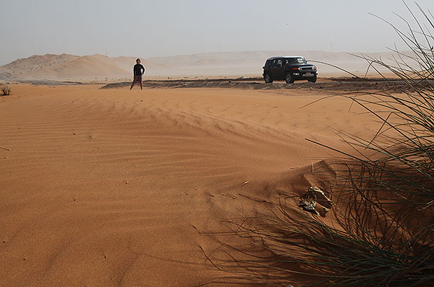
Field GPS navigation in the Arabian desert
Unfortunately, many cases when people got lost in the wild happened not due to the fact that there was no GPS navigator, but because of the banal inability to use it. Choosing the wrong mode of operation, excessive battery consumption, not marked key waypoints and many similar minor errors - turn your navigator, at best, into a primitive compass. At worst, not even to the compass, just to a piece of plastic. But after all, your life may depend on it.
.jpg)
Using your phone as a portable offline navigator
Now we can say that the era of the portable GPS devices is a thing of the past. At the same time, the importance of navigation skills has not lost its significance.
The fact is that the functions of the GPS navigator were fully taken over by the gadget that almost everyone now uses - the mobile phone. For those who are not in the know and do not want to part with their beloved Garmin - even the simplest phone models are equipped with the most modern GPS sensors that allow you to quickly and accurately solve any navigation tasks, from the basic to professional ones.
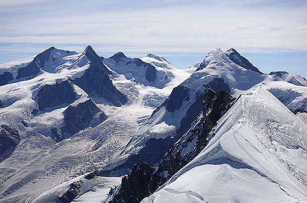
Using a GPS navigator for orientation on climbing routes
Some people will object to me - "I go to the mountains only with a guide, so let him take care of navigation."
By the way, this is one of the most common misconceptions.
The issue of navigation is a matter of your personal, individual safety. Having guide is good, having a good guide is much better, but even a good guide will not give you a guarantee that you will not get lost in the fog 5 meters from the tent, leaving, say, to take a leak. Or that your guide will not be devoured by the main attraction of Kamchatka – some grizzly bear...
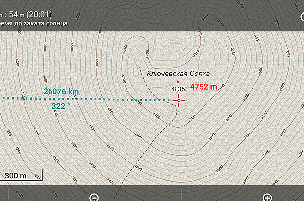
Locus.map software screen with relief of Klyuchevskaya Sopka volcano in Kamchatka
It is clear that the phone itself will not be engaged in your navigation - this requires the installation of additional programs and getting a confident skill in using them.
Remember! At the moment when you will critically need navigation, you would not have time to read the instructions for using the GPS navigator or navigation software. This skill is an absolutely essential part of your preparation for any kind of trips to the wilderness.
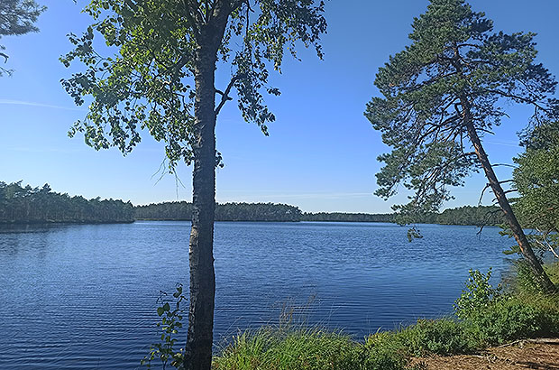
Field navigation in central Russia when searching for the best places for fishing
What applications to choose? In general, there are many programs for navigation. Most of them require an internet connection and provide you with mostly "urban" navigation. Such applications are very useful and popular in a populated area, but completely useless in the wild.
Of course, both Google and Yandex have some primitive offline navigation functions, but still these applications are not designed for the field navigation. The MAPS.me application, almost autonomous from the Internet, also was intended for building road routes - it was an extremely useful program. Unfortunately, after the change of its owners, the MAP.me software has undergone a disgusting update, and has lost much of its value as an offline road navigator.
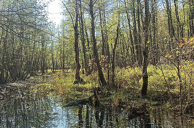
Offline navigation in the forests of central Russia
There is another category of software more specialized in offline field navigation. There is nothing to list here, as there is a clear leader of the entire category - Locus.map - an application that literally turns your phone into a full-fledged navigation station, with all the most modern navigation functions.
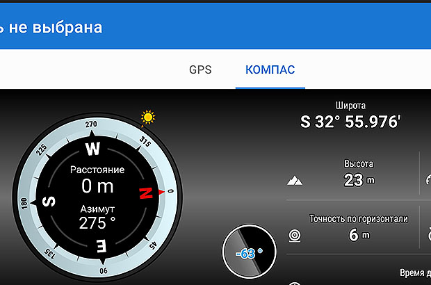
Functional screen of the compass of Locus.map software
A phone with Locus.map installed that is your personal guarantee of safety on any terrain, except perhaps underground. It needs to be clarified. I don't sell Locus.map and I don't receive any advertising fees from them. I just think that there is no more useful program for those who are friends with wildlife. Unfortunately, this software is also useful for military purposes... For this reason, the developers removed it from the Russian segment of google play six months ago
Locus.map screen during navigation within the city
In principle, the functionality of the Locus.map is identical to the functionality of any classic field navigator like Garmin, Magellan, etc. Just in a modern version, this functionality has become much more convenient, understandable and affordable.
The author of the text and photos - Alex Trubachev
Coach and field navigation expert
MCS EDIT 2023
Our Principles
AlexClimb Rule #1 - Safety First
From the very beginning of our activity, here nearly 16 years, the first Principle of work of School of mountaineering and rock-climbing of MCS AlexClimb is the Safety Priority. On the basis of this Principle all process of training is based, all programs and rounds are developed and carried out only within this main principle. We consider that at professional approach to development of programs, at personal discipline and correctly put motivation - occupations by mountaineering and rock-climbing are COMPLETELY safe. And from the return - all troubles and accidents in our sport come from nonprofessionalism, from ignorance or neglect by elementary standards of safety, from irrational motivation, from revaluation of own forces and opportunities. All these prerequisites we COMPLETELY EXCLUDE in our work - ours Rock-climbing, Ice climbing and Mountaineering are based on one Principle - the Safety Priority. In rock-climbing, mountaineering and ice climbing, the Priority of Safety of MCS AlexClimb-is your personal security and comfort irrespective of, than we are engaged - we train muscles and we work technology of the movement in the sports hall and on the rock climbing wall, we make the way through snowstorm to top or we relax on golden sand of the Caribbean beach after hot day of trainings on rocks. The Safety priority - the main credo of School of mountaineering and rock-climbing of MCS AlexClimb.
AlexClimb Rule #2 - Leave No Trace
Closely interacting with Nature, working with the active programs in mountains, woods, lakes and rivers, we perfectly understand the importance of carefull and respectfull bahavior towards the Nature, for its resources. From the very beginning of our outdoor-activity we adopted rules of Leave No Trace technique - the standard of behavior of the person accepted in all the civilized world in relation to environment and especially - to the wild nature. After all on the relation of people to the nature near which they exist, itself can draw dalekoidushchy conclusions on the relation of these people to... Where and as we didn't travel - we don't reserve any garbage, we try to reduce whenever possible our influence on environment to a minimum. We clear earlier zagryazyonny tourist parking of the left garbage, we take out and we take out to utilization places that to us other people left there. We consider that only thus, at personal individual consciousness of each citizen, each tourist, climber or autotraveller, we will be able to keep the nature surrounding us in its state, natural, suitable for life, - in it pledge of the healthy future for ourselves and our children.